
Drive packs
Keep the GPX route, meeting point, waypoints, trip details and crew briefing attached to the same trip.
Use case / Desert GPS UAE
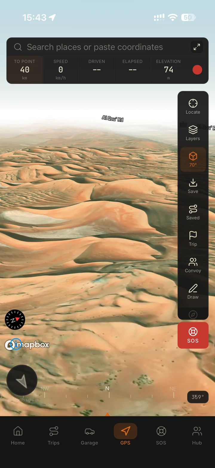
Navra keeps the GPX route, waypoints, meeting information and trip details together, then presents heading, coordinates, altitude, speed and target distance for open-terrain travel.
The practical fit
Road navigation assumes a mapped network and a destination address. UAE desert travel depends on coordinates, heading, current terrain, weather, legal access, vehicle capability and the decisions of an experienced lead.
Navra is designed to organise the digital part of that system: the planned route, key points, crew information and the field display. It does not turn an unsafe line into a safe one.
What it solves
Keep the GPX route, meeting point, waypoints, trip details and crew briefing attached to the same trip.
Download the required areas with Navra Pro before departure. Use terrain and 3D maps to inspect the route alongside heading, coordinates and target distance.
Give the convoy one organised source for the route and trip details instead of several buried chat attachments.
Keep useful drive and vehicle context after the route ends so the next plan starts from what actually happened.
GPS module
The GPS module is built around open-terrain questions: where am I, which direction am I facing and how far is the target? The drive pack holds the wider trip context.
How it fits
Import the GPX, download the needed map areas with Navra Pro, save key coordinates and share the route and meeting point before signal weakens.
Use the field display as one aid while the lead compares it with terrain, conditions, legal access and backup sources.
Save trip and vehicle context, note problems and improve the drive pack before the route is used again.
Straight answers
Yes. GPX route import can be kept with the trip’s waypoints, meeting information and trip details.
Satellite GPS positioning does not need mobile data. Offline map downloads, terrain and 3D maps are available with Navra Pro. Download the areas you need before leaving mobile coverage. Live convoy updates require an internet connection.
Navra is built around UAE off-road travel. Import a GPX route or save waypoints for the area you plan to visit, inspect the available map coverage and download the needed areas with Pro before departure. Check the route against current access and terrain.
No. Terrain, weather, construction, fences and legal access can change. A route file is evidence of a previous plan, not a current safety guarantee or permission to enter.
No. Carry backup power and another navigation source, share important coordinates and the expected return time, and travel with an appropriate group and safety plan.
Download Navra for iPhone or Android. Import your GPX route and prepare offline maps with Navra Pro before departure.